
 |
|
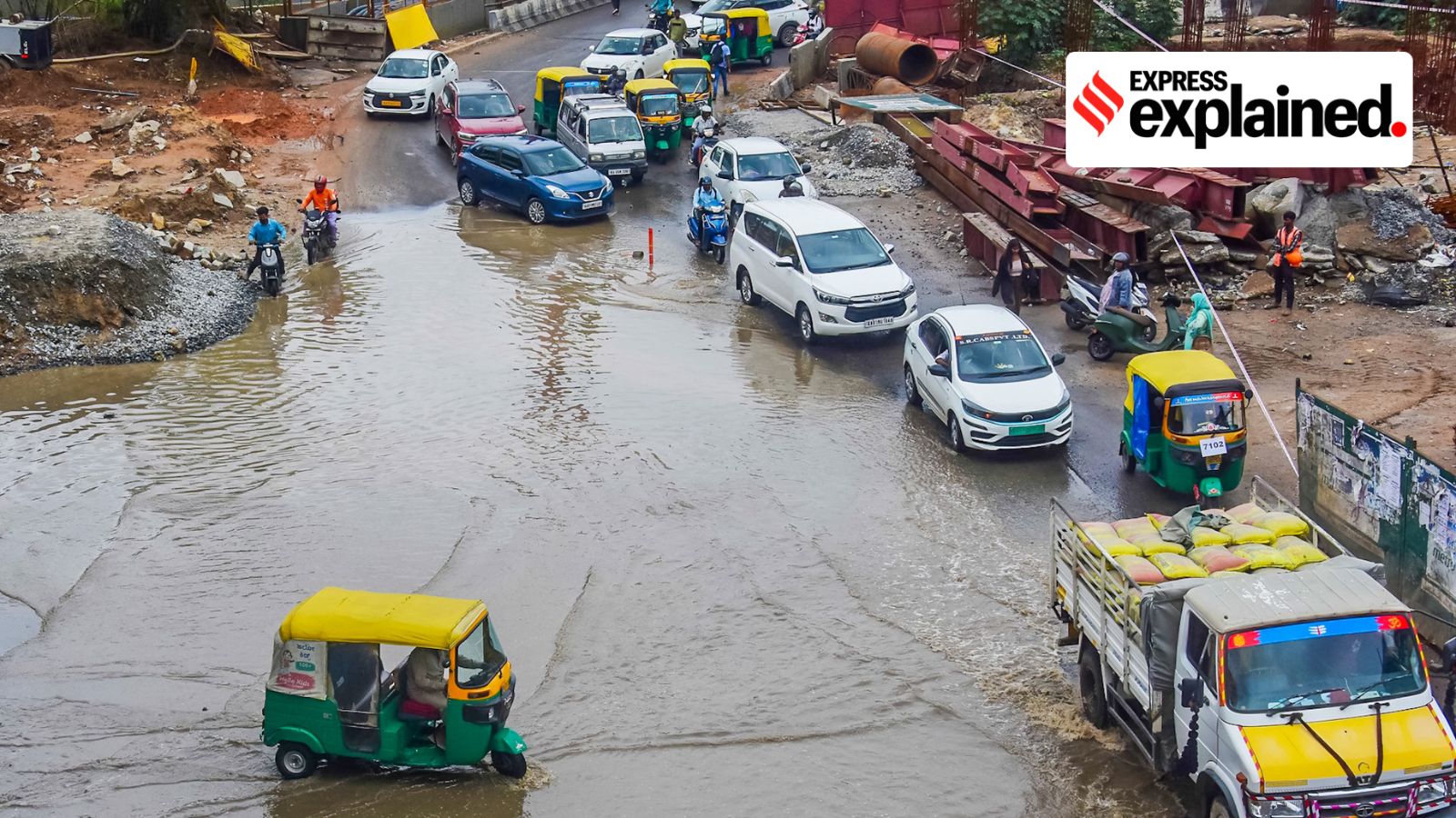
Bengaluru, once known as the 'City of Lakes,' is increasingly becoming synonymous with urban flooding. The recent pre-monsoon thundershowers, which dumped 130 mm of rainfall in a mere 12 hours, brought the city to a grinding halt, underscoring the vulnerability of its infrastructure and the escalating consequences of unchecked urban development. The tragic loss of three lives, the flooding of 500 homes, and the overflowing of over 20 lakes serve as a stark reminder of the urgent need for sustainable urban planning and effective disaster management strategies. The India Meteorological Department's (IMD) red alert for coastal and south interior districts of Karnataka and the orange alert for Bengaluru further highlight the severity of the situation, with flash flood warnings adding another layer of concern. The forecast of extremely heavy rain, thunderstorms, and lightning for the coming days paints a grim picture, demanding immediate and coordinated action to mitigate potential damage and safeguard the lives and livelihoods of the city's residents. The crisis extends beyond mere inconvenience; it represents a systemic failure to balance economic growth with environmental sustainability and underscores the importance of long-term planning that prioritizes resilience and community well-being.
The geographical characteristics of Bengaluru contribute significantly to its susceptibility to flooding. Situated at an elevation of approximately 900 meters, the city lacks a major river system capable of effectively channeling excess water. In the past, Bengaluru's landscape was dotted with numerous interconnected lakes and water bodies, which played a crucial role in rainwater harvesting and flood mitigation. Historical records indicate that in the 1800s, the 740 sq km region boasted 1,452 water bodies with a total storage capacity of 35 TMC (thousand million cubic feet). These water bodies acted as natural reservoirs, absorbing and regulating water flow, thereby preventing widespread flooding. However, the rapid urban expansion of Bengaluru has led to the rampant encroachment of these vital water bodies and their interconnecting valley zones, in blatant violation of ecological norms. This encroachment has severely diminished the city's natural drainage capacity, rendering it increasingly vulnerable to flooding even during moderate rainfall events.
The problem is further exacerbated by the city's outdated and inadequate drainage system. Environmentalists and water conservationists have consistently pointed out that Bengaluru's stormwater drains (rajakaluves) are ill-equipped to handle the city's current population and rainfall intensity. These drains are frequently blocked with solid waste, further impeding water flow and contributing to localized flooding. Vishwanath S, a water expert and urban planner, emphasizes the critical need for the Bruhat Bengaluru Mahanagara Palike (BBMP), the city's administrative body, to implement a comprehensive master plan for building new stormwater drainage infrastructure. He suggests that the Rs 5000 crore loan sought by the Karnataka government from the World Bank should be strategically utilized to develop a state-of-the-art stormwater drain infrastructure, particularly in the peripheral areas of the city. Vishwanath argues that relying on past infrastructure is no longer sufficient to address the current challenges and calls for a comprehensive plan that incorporates local voices and perspectives.
The impact of the recent flooding has been widespread, affecting various zones across Bengaluru. Yelahanka zone, which recorded 103.2 mm of rainfall, witnessed overflowing lakes that caused flooding in low-lying areas, damaging 28 homes. Kengeri's Kote Layout received the city's highest rainfall at 132 mm, resulting in the inundation of at least 100 houses and damage to over 50 vehicles. Koramangala's ST Bed Layout, a perennial victim of monsoon flooding, saw homes submerged under four feet of water, affecting at least 21 houses. In Shanthinagar, the local bus depot was swamped with two feet of water, damaging numerous buses and other vehicles. Sai Layout near Mahadevapura, developed by the Bangalore Development Authority (BDA), was one of the hardest-hit areas, with floodwaters reaching four feet inside homes, prompting authorities to deploy boats to rescue stranded residents. These incidents highlight the uneven distribution of rainfall and the varying levels of vulnerability across different parts of the city.
The government's response to the crisis has been multifaceted, involving both immediate relief measures and long-term planning initiatives. BBMP Administrator Tushar Giri Nath inspected the flood-affected areas, identifying ongoing road-widening work on a railway vent near Geddalahalli as a primary cause of waterlogging. He issued directives to accelerate the completion of the road-widening project to restore proper drainage and mitigate future flooding in Sai Layout. Deputy Chief Minister and Bengaluru development minister DK Shivakumar stated that the civic agency had identified 210 flood-prone zones and had fixed 70 per cent of them. He added that flood prevention work is currently ongoing in 24 areas, and work will be taken up soon in the remaining 20 areas. The government has also invested significantly in building stormwater drains, with 197 km already constructed. These efforts demonstrate a commitment to addressing the immediate needs of the affected communities and implementing long-term solutions to enhance the city's resilience to flooding.
However, the effectiveness of these measures remains to be seen. The completion of ongoing projects, the enforcement of environmental regulations, and the development of a comprehensive master plan for stormwater drainage are crucial steps towards mitigating the risk of future flooding. The government must also address the underlying issues of encroachment and inadequate waste management to ensure the long-term sustainability of the city's infrastructure. Furthermore, community engagement and participation are essential for effective disaster management. Local residents must be actively involved in identifying vulnerabilities, developing solutions, and implementing preventative measures. By fostering a culture of collaboration and shared responsibility, Bengaluru can enhance its resilience to flooding and create a more sustainable and livable urban environment.
The situation in Bengaluru underscores the complex interplay of environmental factors, urban planning, and governance in shaping a city's vulnerability to natural disasters. The encroachment of water bodies, the inadequate drainage system, and the rapid urban expansion have created a perfect storm, making Bengaluru increasingly susceptible to flooding. Addressing this challenge requires a holistic approach that integrates environmental sustainability, infrastructure development, and community engagement. The government must prioritize the protection of water bodies, invest in upgrading the drainage system, and enforce environmental regulations to prevent further encroachment. At the same time, it must foster a culture of collaboration and shared responsibility, empowering local residents to participate in disaster management efforts. By taking these steps, Bengaluru can mitigate the risk of future flooding and create a more resilient and sustainable urban environment for generations to come.
Moreover, the reliance on technological solutions for urban flood management is gaining momentum. Smart sensors and real-time monitoring systems can be deployed to detect water levels in drains and lakes, providing early warnings of potential flooding. These systems can also be used to optimize the operation of drainage infrastructure, ensuring that water is efficiently channeled away from vulnerable areas. Geographic Information Systems (GIS) can be used to map flood-prone areas and identify critical infrastructure at risk, allowing for targeted interventions and resource allocation. Predictive modeling techniques can be used to forecast rainfall patterns and assess the likelihood of flooding, enabling proactive disaster preparedness measures. By leveraging these technologies, Bengaluru can enhance its ability to anticipate, respond to, and mitigate the impacts of urban flooding. However, it is crucial to recognize that technological solutions are not a panacea. They must be complemented by sound urban planning principles, effective environmental regulations, and community engagement to achieve long-term sustainability.
The lessons learned from Bengaluru's experience with urban flooding can be applied to other cities facing similar challenges. Rapid urban expansion, inadequate infrastructure, and environmental degradation are common issues in many developing countries, making them increasingly vulnerable to natural disasters. By adopting a holistic approach that integrates environmental sustainability, infrastructure development, and community engagement, these cities can enhance their resilience to flooding and create more sustainable and livable urban environments. The key is to prioritize long-term planning over short-term gains, recognizing that investing in resilience is an investment in the future. Furthermore, international collaboration and knowledge sharing are essential for addressing the global challenge of urban flooding. By learning from each other's experiences and adopting best practices, cities can collectively enhance their ability to mitigate the impacts of natural disasters and create more resilient and sustainable urban environments for all.
In conclusion, Bengaluru's struggle with urban flooding serves as a cautionary tale and a call to action. The city's rapid urban expansion, coupled with the encroachment of water bodies and an inadequate drainage system, has created a situation where even moderate rainfall events can trigger widespread flooding. Addressing this challenge requires a multi-faceted approach that integrates environmental sustainability, infrastructure development, and community engagement. The government must prioritize the protection of water bodies, invest in upgrading the drainage system, and enforce environmental regulations to prevent further encroachment. At the same time, it must foster a culture of collaboration and shared responsibility, empowering local residents to participate in disaster management efforts. By taking these steps, Bengaluru can mitigate the risk of future flooding and create a more resilient and sustainable urban environment for generations to come. The situation also underscores the importance of technological solutions, international collaboration, and knowledge sharing in addressing the global challenge of urban flooding, ensuring that cities around the world can learn from each other's experiences and create more resilient and livable urban environments for all.
Source: Bengaluru Rains: Why the city frequently witnesses flooding, waterlogging